
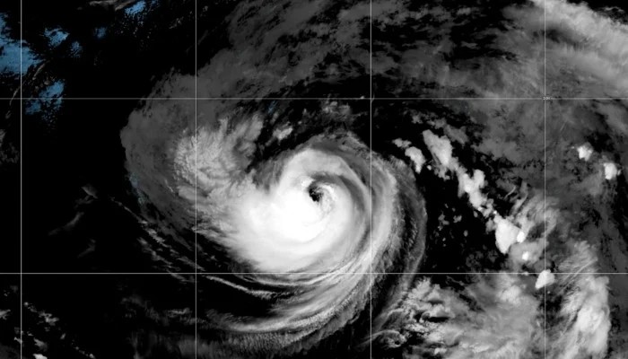
Hurricane Karina developed in the Pacific Ocean on Sunday, August 30, and rapidly intensified into a major storm within hours, sustained by warm waters off the coast of Baja California. According to the National Hurricane Center in Miami, Hurricane Karina developed Category 1 status early Sunday with winds of 80 mph (130 kph) and then intensified to a Category 3 hurricane with winds of 125 mph (205 kph). Meteorologists said the storm's centre is located on the tropical disturbance developing in the Pacific, with further strengthening possible in the next 24 hours.
On Sunday, August 30, Karina was situated about 960 miles (1,545 kilometres) west-southwest of the southern tip of Mexico's Baja California Peninsula and was heading west at 9 mph (15 kph). However, the centre has not issued any coastal warnings at the moment. National Weather Service Meteorologist Bryan Lewis told KTLA 5 that the National Hurricane Center forecasts an 80% chance of a tropical depression with wind speeds below 38 mph developing in the area within the next two days.
The storm is expected to bring heavy rainfall and extreme humidity to Southern California that would continue into the following week, which could cause flooding. The last tropical storm that hit landfall in the region was in 1939. Meteorologists continue to monitor the storm's trajectory closely as local authorities prepare emergency response measures for coastal communities.
The storm's threat level is fuelled by a "super" El Niño developing in the Pacific Ocean. The climate pattern, El Niño, creates warmer ocean temperatures in the Eastern Pacific, triggering marine heat waves. According to National Weather Service data, Southern California is currently seeing a surge in sea surface temperatures 5 to 10 degrees above average for this time of year.