
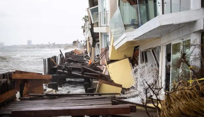
Large waves from remnants of Tropical Storm Rachel slammed into homes on the beachfront in Long Beach, California, over the weekend. The National Weather Service forecasters predicted that the worst has passed for Southern California, but threats remain for communities along the coast.
Long Beach city authorities have red-tagged 13 homes on the peninsula, meaning all residents were forced to evacuate, ahead of the rise in water levels from the remnants of Rachel, which tracked inland from Baja, California, late Saturday night. Wind advisories across inland deserts were set to expire early Monday morning, while coastal flooding advisories from San Diego through San Luis Obispo will remain intact, with another round of potentially high tides expected for Monday and Tuesday mornings.
Currently, the most extreme high currents are happening between 10 and 11 a.m., with milder secondary high tides around 11 p.m. Although the morning high tides over the weekend qualified as minor flooding, the nighttime high tides did not. The forecasters of the National Weather Service have also predicted Monday's and Tuesday's morning tides would scale up around 7.5 feet.
The coastal flooding advisories also include areas farther north, in Santa Barbara and San Luis Obispo counties, stretching through Monday morning's high tide. The advisories farther south, from San Diego to Ventura, extend through Tuesday, October 13, 2026.
The NWS forecasts Southern California will swing to the other side of the spectrum by the end of the week: high temperatures are expected, dry air and some of the first Santa Ana winds of the season are also on the way, bringing a heightened potential for wildfires.
The service has projected that the fire weather would start Thursday, October 15, and last through Saturday, October 17. Local emergency response teams remain on high alert across the affected coastal corridors to assist any residents in need of urgent shelter.