
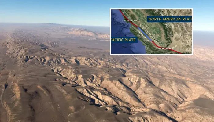
Three minor earthquakes have rattled across California overnight right along the San Andreas Fault, the U.S. Geological Survey (USGS) reported. The quakes were registered in the mid-magnitude 2 range across Northern and Southern California on Sunday, November 1, 2026.
A small 2.7-magnitude earthquake was detected in Petrolia at around 4:31 a.m., followed by a 2.6-magnitude shake felt in Santa Barbara near 4:39 a.m., according to a USGS Latest Earthquakes Interactive Map. Westley was also shaken up with a magnitude 2.5 quake on Saturday night.
The most recent major earthquakes along the San Andreas Fault were recorded in Loma Prieta in 1989 and San Francisco in 1906. Local media reports highlight that six tremors with a magnitude of 2.5 have jolted the region over the last week.
The strongest, a 2.9 scale quake, jolted the same area on October 31. According to the USGS, magnitude measures the energy released at the source of the earthquake, replacing the old Richter scale.
Quakes between 2.5 and 5.4 magnitude are often felt but rarely cause significant damage. According to the U.S. Department of Homeland Security, sudden, rapid shaking can trigger fires, tsunamis, landslides, or avalanches.
They can happen anywhere but are most common in Alaska, California, Hawaii, Oregon, Puerto Rico, and Washington. Estimates suggest there are 500,000 traceable earthquakes globally each year; 100,000 are felt, and 100 cause property damage or loss of life.
The San Andreas Fault stretches roughly 800 miles through California, marking the boundary between the Pacific and North American tectonic plates. The region has produced significant seismic activity in the past, including the destructive 1906 San Francisco event.
With this record in mind, even modest secondary activity draws the spotlight from scientists and emergency planners. Minor quakes like those recorded overnight are common along the fault and serve as reminders of ongoing plate movement.