
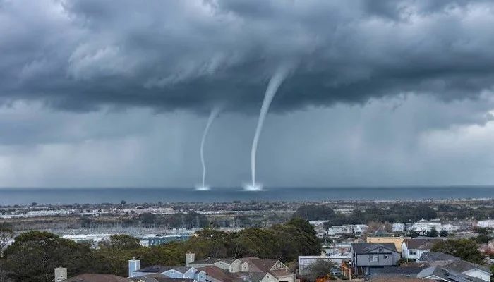
A pair of rare waterspouts spun over San Francisco Bay on Monday, November 16, prompting federal forecasters to issue marine warnings.
- No waterspouts recorded over the Bay in 28 years.
- FAA delayed 280 flights at SFO.
- Waves up to 35 feet expected.
Waterspouts over the Bay
The twin spouts churned over water near Candlestick Point as a powerful early‑season storm system moved through northern California. The National Weather Service issued a Special Marine Warning for the bay south of the Bay Bridge shortly after noon. According to NOAA's storm events database, no waterspouts had been recorded over San Francisco Bay in the last 28 years.
Tornado Warning in Santa Cruz
The same unstable weather prompted a rare tornado warning for parts of Santa Cruz County, including Boulder Creek and Davenport. Radar detected rotation in a severe thunderstorm, but the warning expired without a confirmed tornado.
Air Travel Disruptions
The storm also disrupted air travel. The FAA placed San Francisco International Airport under a delay program due to rain and reduced visibility. Airport officials said about 280 flights, roughly 25 percent of all flights, were delayed.
Future Weather Outlook
Forecasters cautioned that hazardous waves could continue slamming the shores, with waves ranging between 20 and 25 feet and breakers up to 35 feet tall. The same atmospheric conditions that produced the waterspouts were also likely to cause further weather disturbances through the coming week. The heaviest rains were expected on Wednesday and Thursday. Up to four feet of snow was forecast for the Sierra Nevada area, which would make travel through the mountainous regions difficult during mid‑week. Forecasters advised people to turn on emergency alerts on their phones.